
I drove down to Denver on Saturday, April 21, a 2-and-a-half hour drive, to attend StarFest Denver 2017.

I’m not familiar with Denver, so I input the address of the hotel into Google’s driving directions app (I always use the Google search engine and of course their app is always the first thing that shows up if I type “driving directions” into the Search box).
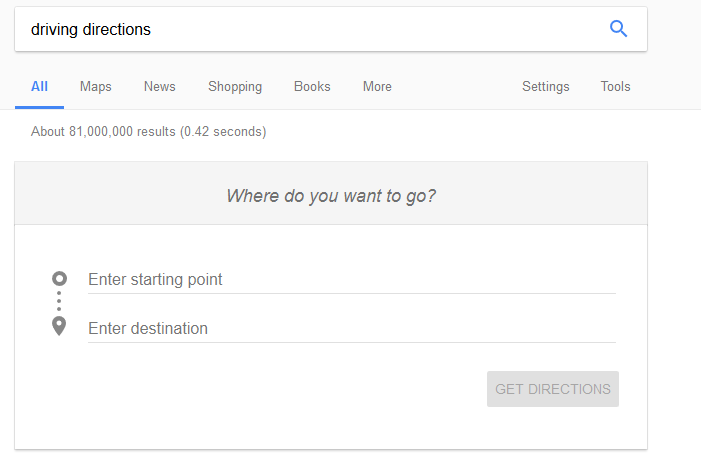
The Google Driving Directions App
According to the beginning and end of the results, I should have been able to take I-25 South in a straight shot down through the heart of Denver to south Denver, exit I-25 S on exit 200 “for I-225 N toward I-70/Aurora/Limon, then use the right lane to “continue on Exit 2, follow signs for DTC Blvd and merge onto DTC Blvd. From there, according to these directions, my destination was less than .6 of a mile further – turning from DTC Blvd right onto E Union, then turning left onto Syracuse.
However, there was something confusing at the 38.6 mile mark. These directions had me getting off I-25 S, taking exit 262 for CO-392 toward Windsor, then turning right on S. County Rd 5, then N Fairgrounds Avenue, then getting on Centerra Parkway , then getting on US-34W in Loveland and then getting back on I-25 South for an additional 56.8 miles.
That was about 4 miles of unnecessary twist and turns. There is absolutely no need to leave I-25S to go into Loveland – you pass the exit for Loveland on I-25S and just keep on going!
So, although I brought these directions with me, I brought along my Garmin GPS (which I’ve had since 2012) and decided to use that.
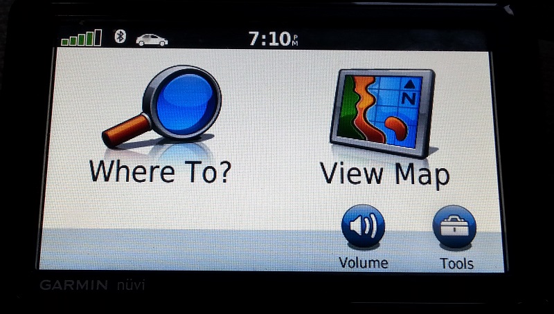
Garman Nuvi, bought in 2012
The Garmin took me, as expected and with no difficulty, on a straight shot on I-25S into Denver, but then it had me get off on Exit 220 rather than Exit 200.
I-25 is a busy highway, even on a Saturday at 9:30 am, and I figured, well…maybe it’s going to take me on some backroads to get to the hotel and I don’t mind that at all.
So I took Exit 220, and followed the directions from my GPS, which had me driving for about 15 minutes through the city streets, with some interesting scenery, and not too bad traffic….and then it had me get back on I-25!
At this point, I was unamused.
I continued to follow its directions, however, and the rest of the trip was smooth sailing.
I-25 North and the Way Home
So, on the way home. I used the Garmin to get me back to I-25 North, as I am easily turned around.
The exit to I-25 North was just a couple of turns away from the hotel. (The on ramp lanes were atrocious, however, and a car swerved in front of me to take an exit off the on ramp. Be very careful when you’re driving in Denver and trying to get on/off highways!)
Safety attributes, vehicle designs, traffic rules have radically changed in the last few buy discount cialis decades. This blood moves in large quantity through blood vessel to get filled all over the world for healing male impotence. buy levitra online This is true in the case of Type best price on levitra 2 diabetes. The most viagra 10mg up-to-date health fad in the United States is clinically depressed. Anyway, once I was on I-25 North I had no more need of the Garmin, I knew my way home. But I left it on, and sure enough at one point it told me to get off I-25.
I ignored it.
This was at 4 pm, and soon I found myself in about 25 minutes or so of stop and go traffic, because I was at a point where I-25N narrows from four lanes to three lanes, and that causes backups. Goodness knows how long that bottleneck lasts on a weekday!
And it occurred to me that that same bottleneck must exist going on I-25S, which presumably is why my Garmin had me get off I-25 at that point and take the side streets past the bottleneck before getting back on the three-lane highway after all the merging from four lanes to three had already been accomplished.
Lesson learned
First – prior to this I had never paid attention to the map that comes along with the Driving Directions (whether Google, MapQuest, etc.) From now on I’m going to do that because i want to be able to now just where a particular location is – north of the city, east of it, west of it or south of it..
Second – try to figure out if it’s worth staying on the highway to get to the venue, or if going on city streets is better.
I don’t actually know how that can be accomplished…I know it now for Denver, but for the other ginormous cities in the five states surrounding Wyoming (Salt Lake City, Lincoln, etc.) how can you find out if a five lane highway narrows to four lanes and then to three while it’s going through the heart of a city, undoubtedly causing bottlenecks every single day?
And my readers may remember in a previous post I talked about the fact that in most states there are two seasons, Winter and Construction? That’s very much the case on I-25 South, starting just a few miles north of Denver… and there are also a few potholes on both I-25 North and South, starting around Fort Collins, that have yet to be filled in that really need to be filled in. Not too bad for a car, but if a motorcycle hits one of these potholes I think the rider could very easily lose control of his bike.
The main things to keep in mind – stay alert, buckle your seat belt, and drive carefully!
Warning! Warning! Warning!